And the Highest County in the UK is…….

The United Kingdom is not ‘high country’. Although the highest peaks reach over 1300m above sea level at their summits (that’s over 4000 feet in ‘old money’), and certainly seem pretty high to those who choose to climb them, on a global scale we are very much a low country. The UK ranks only 31st in Europe for its highest point.

Despite the mountains of the north and west of Great Britain, the average height above sea level is only 75m** – and that is the height of the city of Shrewsbury in Shropshire or the town of Callendar in Perthshire. For England alone the average height is of course lower – only 54m, which is the altitude of the city of Derby in the East Midlands. Not surprisingly, Wales, Northern Ireland and Scotland have a higher average altitude than England, with their average height represented by the towns of Denbigh in Denbighshire, north Wales (81m asl (above sea level)); Broughshane in County Antrim, Northern Ireland (64m asl); and Aberfeldy on the River Tay in Perthshire (87m asl). Using these towns and heights as a benchmark, you can discover whether your own home, village or town sits at an altitude that is higher than the average for your own part of the UK.

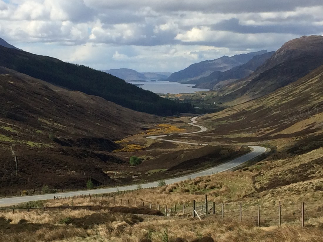
So where is the highest county in the UK? This might seem a straightforward question, as the highest point of Ben Nevis (1345m or 4411’) (Grid Reference NN16607120) is in the ceremonial county of Inverness-shire. And as Inverness-shire also has significant lengths of coastline, it is not only the highest county but also the county with the greatest vertical extent –that is 1,345m from its lowest to its highest point! Most counties in the UK include a stretch of coastline, so for most of us it is easy to compare our own home county with the record-holding county of Inverness-shire by simply identifying the highest point in the county (or “County Top”). But what about those counties that don’t have a coastline? Is the highest county the one that reaches the absolute greatest height or is it the one whose lowest point is furthest above sea level?  Let’s look at a couple of examples.

In England, the county whose lowest point is highest above sea level is the ceremonial Metropolitan County of the West Midlands, which includes the cities of Birmingham, Coventry and Wolverhampton. The lowest point in the West Midlands County is 64m above sea level at Stonebridge Meadows, just outside Coventry (Grid Reference SP34607560), and that is higher than any other county in England. Although it may be the highest county in terms of its minimum height, though, the West Midlands is not especially high at its highest point. Its County Top is only 271m asl, at Turners Hill, Oldbury, in the Borough of Sandwell (Grid Reference SO96708870), and that means the county is only 207m in altitude between its lowest and highest points – Inverness-shire is over six times as high!

In Scotland the highest county as measured by its minimum height above sea level is the ceremonial (and historic) county of Peeblesshire, now part of the Scottish Borders Council district of southern Scotland. Peeblesshire’s highest point is 840m at the summit of Broad Law (Grid Reference NT14602350), but its lowest point is 120m asl at Thornielee on the River Tweed 5km west of Galashiels (Grid Reference NT41993626). So b this lowest altitude measure Peeblesshire is actually 12om higher than Inverness-shire.

For those who live in the lowest lying parts of the country, we might also ask the question about which county is the ‘flattest’ in the UK i.e. which has the smallest vertical difference between its highest and lowest points. Historically this was the county of Huntingdonshire (part of the county of Cambridgeshire since 1974) in the Fens of East Anglia, with a height difference of only 84m from its lowest point 2.5m lower than sea level at Holme Fen near Peterborough (Grid Reference TL20608870) to its County Top at Three Shire Point (aka Boring Field !) at a height of 81m asl (Grid Reference TL04907120). Today, though, it is the county of Norfolk, also in East Anglia, which can lay claim to being the UK’s ‘flattest county’, for Norfolk stretches from sea level along its extensive coastline to a height of only 103m at Beacon Hill near to Sheringham. So nowhere in Norfolk is as high as the lowest point in Peeblesshire!

So ……. what are the highest and lowest counties in the UK???

(** The altitude figures used here are from www.dateandtime.info, which derives them from the Global Digital Elevation Model GTOPO30)

And Finally….!

The Must Get Out More Question !

Where is the smallest church in the UK, and how large (or small!) is it?


The Answer to the Last Question

Which is the highest offshore island in the UK (i.e. not on the mainland of Great Britain or Ireland) ?

The highest offshore island in the UK is the Island of Mull, lying in the Inner Hebrides just off the west coast of Scotland, in the ceremonial count of Argyll and Bute. Its highest point is Ben More, which reaches 966m and is the 7th tallest mountain in the British Isles (Grid Reference NM52573307).


The Record Locations

You can use the Grid References provided to locate record locations on a map at www.streetmap.co.uk

Seeing in the New Decade

Happy New Year! Many people see the New Year as a chance to seek fresh challenges and throw off any of the negatives of the past year – a time for new beginnings and new horizons. New Year traditions emphasise change, whether celebrating with friends, watching the fireworks or having a few glasses of wine (see the answer to last month’s MustGetOutMore Question, below!!!!). A recent New Year’s fashion, and not just amongst mountaineers, has been to climb the highest local hill on New Year’s Day.  In some cases this means an early start to see the dawn of the New Year at the summit, and for a few hardy souls the challenge is to climb late at night on New Year’s Eve to see in the New Year at the summit! Whatever the hill or the timing, it is a good way to start the year, with a challenge completed and, weather permitting, the joys of a clear long view – just what is needed as you head into the New Year and, this year, a new decade!

Getting to the highest hill top is obviously easier in some places than others. Climbing Arthur’s Seat, the highest point in the City Edinburgh (251m high) (Grid Reference NT27537295), is a straightforward stroll, for example, whereas summiting Ben Macdui in the Cairngorm Mountains (at 1309m, the 2nd highest mountain in the UK and the County Top for Aberdeenshire) (Grid Reference NN98909890) is only for the seasoned mountaineer with the right equipment and a good weather forecast. And then there’s a key question – which hill is really the one to climb! It’s easy to find a list of the County Tops – the summits which are the highest points above sea level in each county. But just as each county has its County Top, so each county also has its Most Prominent Hill – this is the hill or mountain with the greatest ‘drop’, which is the height its summit above its surrounding landscape rather than sea level. And the County Top and the Most Prominent Hill aren’t always the same place!

The county of North Yorkshire is renowned walking country with the beautiful hills and valleys of the Yorkshire Dales and North York Moors National Parks. In the far north west of the county lie the famous “Three Peaks” of Whernside, Pen-y-Ghent and Ingleborough. All are accessible to walkers and not just mountaineers and all provide a fantastic long distance view from the top. The tallest of the three is Whernside (Grid Reference SD73858142), which is the County Top of North Yorkshire at a height of 736m above sea level. But Whernside is not the Most Prominent Hill in the county. That honour falls to Ingleborough (Grid Reference SD74127459, which although its summit stands “only” 724m above sea level, is actually 427m above the surrounding landscape – and that is a full 19m greater than Whernside’s ‘drop’. So the County Top and the Most Prominent Hill are not the same place – and that means that at the same time Whernside is 12m higher than Ingleborough and Ingleborough is 19m taller than Whernside!

In the northern part of the West Midlands the county of Staffordshire has a similar situation. The highest point in the county lies in heather moorland at 519m above sea level on the northernmost county boundary. But while it’s the highest place you can be within Staffordshire, it’s a bit of a disappointment because it’s just a point on the south west side of Cheeks Hill (Grid Reference SK02506980), whose actual summit is about 25 metres to the north, a few metres or so higher in altitude, and actually over the border in Derbyshire. It’s not even the Most Prominent Hill in the county, for that lies some 10km to the south west – ‘The Cloud’ (Grid Reference SJ90406370), which is on the county’s north-west boundary with Cheshire about 4km north east of Congleton can be seen from a long distance away, and although it is only 343m high, it stands proud and prominent at 177m above the valley of the River Dane.

Much further south the county of Kent also has a different County Top and Most Prominent Hill. The highest hill in Kent is Betsom’s Hill, just north of Westerham on the North Downs, whose summit is 251m above sea level (Grid Reference TQ43535639). Betsom’s Hill is unique amongst County Tops in the UK in being the only one which is not accessible, as it is on private land. Perhaps it is a good thing, therefore, that the Most Prominent Hill is some 20km east. Detling Hill stands just north of Maidstone on the chalk of the North Downs, and provides a popular walk and viewpoint. Although only reaching a summit height of 200m, which makes it only the 9th highest hill in Kent, its ‘drop’ of 163m makes it the most prominent in the county (Grid Reference TQ80495865). It makes a great destination at any time of the year, but is certainly an impressive place to celebrate the New Year.

You can find out which hill is the County Top in your own county and also which is the Most Prominent Hill, by visiting the website at www.hill-bagging.co.uk

And Finally….!

The Must Get Out More Question !

Which is the highest offshore island in the UK (i.e. not on the mainland of Great Britain or Ireland) ?


The Answer to the Last Question

Actually, two questions for you to think about while you enjoy a glass of wine over the Christmas and New Year festivities…….Where is the largest vineyard in the UK? : and, Where is the largest wine producer in the UK?

The UK has 672 vineyards which between them cover 1675ha. The largest single vineyard is Denbies, just north of Dorking in Surrey, which has 90ha in vines (Grid Reference TQ16555114). The Nyetimber vineyards at West Chiltington, 3km east of Pulborough in West Sussex actually cover a larger area (171ha), but their vines are planted across 7 detached and separate plots (Grid Reference TQ07911879). The largest wine producer in the UK is Chapel Down, which is located at Small Hythe, 4km south of Tenterden in Kent (Grid Reference TQ89213040). It has ‘only’ 78ha of its own vineyards but also buys grapes from many other vineyards across south east England to make its award-winning wines. All three of these ‘largest’ wine growers and producers have a Visitors Centre open for most of the year where their wines can be tried and tasted.


The Record Locations

You can use the Grid References provided to locate record locations on a map at www.streetmap.co.uk

Down on the River Bank

Autumn 2019 has seen a major crisis in the banks – that is, the river banks, where the exceptional rainfall in October and November has produced extensive flooding and substantial damage to property and hardship to people, most notably along the River Don in South Yorkshire. Our rivers are an important part of our local landscape and except for when they are in a dangerous flood state they provide a great outdoor destination. In spring and summer this may conjure up images of sunny walks, picnics and ‘messing about in boats’. In autumn and winter, though, they may simply provide a mean and moody backdrop to ‘getting out more!’.

Every county has its own record river locations, and one of the most interesting is to identify the longest river in the county. The longest river is very often the widest river, too, and also the river with the greatest flow (discharge), usually at the point where it either flows into the sea or, for a landlocked county, where it flows out of the county. But this is not always the case, as the examples below show all too clearly!

The county of Worcestershire in the West Midlands is dominated by the River Severn, which passes through on its way from the slopes of Plynlimon in the mountains of Wales to the Bristol Channel. The Severn is the longest river in the UK (354km), and flows for 61.25km through Worcestershire from 7km north of Kidderminster (Grid Reference SO75408240) to 1km east of Tewkesbury (in Gloucestershire) (Grid Reference SO88303300). It is the largest river in Worcestershire in every dimension (length, width and discharge) and so these record locations for the county can be ‘ticked off’ in a single visit.

Similarly, in Greater London the River Thames provides all of the main county river records. The river flows for 68.5km through Greater London from Hampton in the Borough of Richmond-upon-Thames (Grid Reference TQ12506890) to Rainham Marshes in the Borough of Havering (Grid Reference TQ53507910)), before heading into the Thames Estuary and out to the North Sea.

But other counties don’t have such simple ‘record’ rivers. For example, ask the question ‘What is the longest river in East Sussex?’ and there are three possible correct answers – the River Medway, the River Rother or the River Cuckmere. The first ‘correct answer’ is the River Medway, which is the longest river that flows, at least in part, through East Sussex. It is 113km long from its source at Turners Hill in West Sussex (Grid Reference TQ34903764) to its mouth near to Chatham and Gillingham in North Kent (Grid Reference TQ78026996), and while most of its course is in Kent (92km) it also runs through the northern part of East Sussex for 16km. The second ‘correct answer’ is the River Rother, which is the river that has the longest course within East Sussex. It rises at Rotherfield near to Crowborough and then flows eastwards to eventually reach the English Channel at Rye Harbour. Its total length is 56km of which 53km are in East Sussex –north of Rye, however, it flows in Kent for just 3km, where it is known as The Kent Ditch, and this means it is not entirely an East Sussex river. The third ‘correct answer’ is the River Cuckmere, which is actually the longest river that flows entirely within the county of East Sussex. Its source is just east of Heathfield and it then runs south for 31km until it flows into the English Channel at the famous and beautiful location of Cuckmere Haven, set between the chalk cliffs of Seaford Head and the Seven Sisters (Grid Reference TV51649773).

The county of Derbyshire also has more than one correct answer to the question ‘What is the longest river?’. The longest river that flows in part through Derbyshire is the River Trent, which forms part of the southern boundary of the county on its 296km journey from the Staffordshire Moorlands to the Humber Estuary near Hull. But it is the River Derwent that is the river with the longest course in Derbyshire and also the longest river that flows entirely within the county. Its 106km course runs from the slopes of Bleaklow Hill in the ‘Dark Peak’ of the Peak District National Park (Grid Reference SK12609680) to the point where it joins the River Trent at Derwent Mouth, just south of Derby (Grid Reference SK45803080).

So, when it comes to identifying the longest river in your own county you may find there are several possible answers. You can take your pick, therefore, about which is the real right answer to the question –  or, of course, you could take the opportunity to visit ALL of the longest rivers in your patch of the UK.

And Finally….!

The Must Get Out More Question !

Actually, two questions for you to think about while you enjoy a glass of wine over the Christmas and New Year festivities…….Where is the largest vineyard in the UK? : and, Where is the largest wine producer in the UK?


The Answer to the Last Question

Where is the oldest working lighthouse in the UK?

The Bell Rock (or Inchcape Rock) Lighthouse stands 11km offshore in the approaches to the Firth of Tay, south east of Arbroath on the east coast of Scotland. It was constructed by Robert Stevenson between 1807 and 1810, and is 35m tall. It is also the oldest sea-based lighthouse in the world, and has been fully automated since 1988. (Grid Reference NO76122694)


The Record Locations

You can use the Grid References provided to locate record locations on a map at www.streetmap.co.uk

“Remember, Remember…….”


November is a month to remember! In the UK we remember Guy Fawkes and the Gunpowder Plot on the 5th of the month, then move from these historic, almost folk, tales and the thrills of bonfires and fireworks, to the poignant Remembrance events of November 11th, recalling the horrors and heroes of the wars of the 20th century. Wherever you live in the UK the memory of the Great War and of World War II is captured by the numerous war memorials in churches and public buildings and in the great public spaces of our local villages, towns and cities. And these war memorials add to our “record” landscapes as every county has its largest and oldest which can be visited as we try to “get out more”.

Most of our war memorials date from the 20th century, built in the wake of the conflicts of 1914-18 and 1939-45. The oldest in the UK, though, have a much longer history. The oldest identifiable war memorial is found in the churchyard of the Church of Scotland in the village of Aberlemno in the historic county of Angus, near Dundee in Scotland. Here one of several carved standing stones dated to the 8th century illustrates figures of Pictish Warriors, which are believed to be scenes from the Battle of Dunnicken fought nearby on the 20th May 685AD (Grid Reference NO52245555). The oldest war memorial in England is very different in character, for it is All Souls College, one of the oldest colleges of Oxford University. It was founded in 1438 by Henry VI and endowed by Henry Chichele, the Archbishop of Canterbury, to commemorate the victims of the Hundred Years War between England and France. Historically the College Fellows were required to pray for those killed in the battles of the long war (Grid Reference SP51600631).

Our more traditional image of a war memorial is of a plaque with a list of those local men (and more recently, women) who died in war. The oldest example of this type of memorial is in the parish church of St. Leonard, in Middleton in Rochdale Metropolitan Borough (Greater Manchester). The memorial is a stained glass window (“The Flodden Window”) which dates from 1524. The window was installed when the church was consecrated, and was endowed by Sir Richard Assheton to commemorate the Battle of Flodden Field on 9th September 1513, after which Sir Richard received his knighthood from Henry VIII for bravery in battle. The window lists the names of the 16 archers from Middleton who lost their lives in the battle (Grid Reference SD87210631).

The historic county of Staffordshire has national and local ‘record’ war memorials. Most famous, and perhaps the second most familiar war memorial in the UK after Whitehall’s Cenotaph in London, is the National Memorial Arboretum at Alrewas, 8km north of Lichfield. Dedicated by the Queen in 2007, this is the largest war memorial in the UK, extending over 61ha and including over 350 separate memorials. At its centre is its largest individual memorial, the Armed Forces Memorial, and the Arboretum is also home to the National Remembrance Centre, opened in 2017 (Grid Reference SK18221455).

Two other ‘record’ war memorials are noteworthy in Staffordshire, though. Firstly, the county’s oldest war memorial is one of the oldest Boer War memorials in the UK. The Hanley Boer War Memorial was unveiled in October 1902, only five months after the war’s end. The plaque contains the names of 9 local men who died in the conflict, and is located in the former Hanley Town Hall, in Albion Street, Hanley, in the city of Stoke-on-Trent (Grid Reference SJ88284738). Secondly, the tallest war memorial in the county is one of the tallest in the UK. The Nicholson Memorial in Derby Street, Leek, was commissioned in 1925, and is 27m in height. It was donated to the town by a local businessman Sir Arthur Nicholson and his wife to mark the loss of their own son in the First World War (Grid Reference SJ98615652). Just for comparison, the tallest war memorial in the UK is the Elveden War Memorial, at Elveden in Suffolk, which is 39m tall and can be ascended by 148 steps inside. Unveiled in 1921 it was gifted by the Guinness family who owned the Elveden Estate nearby (Grid Reference TL78807762).

 So, why not “get out” and visit the record war memorials close to you during November?


And Finally….!

The Must Get Out More Question !

Where is the oldest working lighthouse in the UK?


The Answer to the Last Question

On the theme of wind power, where is the oldest working windmill in the UK?

The oldest windmill in the UK which is still working is the Outwood Windmill at Outwood, on the east side of the M23 motorway in Surrey, built in 1665. The mill is privately owned and not open to the public (Grid ReferenceTQ32804560).


The Record Locations

You can use the Grid References provided to locate record locations on a map at www.streetmap.co.uk

Blowing in the Wind


“Windmills on the hills,

Windmills on the ridges

Whistling wind whirls wildly.

Generating electricity


We watch the whirling blades,

Waving their flailing arms,

Giants on the horizon,

Minimal simplicity”


From “Wind Turbines” by Audrey Christopherson

Like them or loathe them, wind turbines and wind farms have become a significant part of the landscape over the last three decades. Thinking about the record places in our local landscapes and across the UK we always focus on the natural world (the highest hills?) or historical places and features (the oldest church?). It’s easy to forget that the landscape changes continuously, and that new features have become important – and few of us now live far from the giants of sustainable energy which are the goliath wind turbines. The first onshore wind turbines in the UK were built as recently as 1991, and the first offshore windfarm opened in December 2000 – but today there are over 8000 wind turbines across the UK and its offshore waters, which generate 18% of our electricity. This makes us the largest generators of electricity from wind turbines in the world, producing one third of Europe’s wind power.

So where are the ‘record’ wind farms in the UK? Almost every county now has at least one wind turbine within its boundaries, but the largest collections of turbines in wind farms onshore are found mostly in the windy upland and western regions. The oldest onshore wind farm is at Delabole in Cornwall (Grid Reference SX08528504), which opened with 10 turbines in 1991. Although it has had a chequered history, and hosted a now closed visitor centre for many years, it is still operational, producing about 400kw of power.

The largest onshore wind farm is Whitelee Wind Farm at Eaglesham, 20km south of Glasgow, which has 215 turbines producing up to 539mw of power, or enough to provide electricity to 375,000 homes. The Visitor Centre at Eaglesham (Grid Reference NS59914599) provides a spectacular viewpoint and a great insight into the scheme. The largest onshore wind farm in England is on the south coast of Kent at Little Cheyne Court (Grid Reference TQ98222193), which stands on Romney Marsh, 7km west of Lydd. Its 26 turbines are 115m tall, and generate nearly 60mw of power.

Onshore wind farms still generate more than half the wind power in the UK, but that will change by 2020 as new offshore sites become operational. The first offshore wind farm in the UK was opened at Blyth in Northumberland in December 2000, but was decommissioned and removed in early 2019. That means that the oldest offshore wind farm still operational is the North Hoyle Wind Farm which stands in Liverpool Bay 7.5km north of Rhyl on the North Wales coast (Grid Reference SJ07009389). Opened in December 2003, its 30 turbines produce 60mw of electricity.

When it comes to identifying the largest offshore wind farm, the champion changes frequently. Until 2018 it was the London Array, whose 175 turbines generate 630mw some 11km north of North Foreland on the Thames Estuary in Kent. (Grid Reference TR45839993). In June 2018, though, the Walney Extension Wind Farm, 14km west of Walney Island on the coast of Cumbria, was commissioned with 87 turbines generating 659mw of power, making it the largest wind farm in the world (Grid Reference SD00356198). But Walney Extension’s ‘champion’ status will be short-lived. Early in 2020 the new Hornsea One Wind Farm in the North Sea, 120km off the coast of Lincolnshire will become fully operational (Grid Reference TB49104988), making it the furthest  from shore that an offshore wind farm has ever been built. Although it already provides power to the National Grid, when complete it will generate 1200mw of electricity, and will be the largest wind farm in the world. Most offshore wind farms are visible from the nearest coastline, of course, and are therefore a significant part of the seascape. Hornsea One will be the exception, as it is not visible from land – the nearest you can get without a boat is Horseshoe Point, near Marshchapel on the Lincolnshire coast (Grid Reference TA38160185), where the power cable from the wind farm comes ashore on its way to Killingholme Power Station in north Lincolnshire. Hornsea One is, though, unlikely to remain the largest offshore wind farm for very long!!

So what about your own locality and county? You can find the location of all power generation sites, including wind turbines, on the map at www.mygridgb.co.uk , so you can identify the nearest and largest sites quite easily. In East Sussex, for example, there are two operational wind farms. The ‘oldest’ is the three turbine Shepham Wind Farm at Polegate, just north of Eastbourne (Grid Reference TQ60100551), which has been generating power since 2017. The largest is the new offshore Rampion Wind Farm, commissioned in 2018 in the English Channel 13km south of Brighton and visible from much of the Sussex coast, whose 116 turbines produce 400mw of power. In Greater London there is only one wind farm site, with two turbines, which is at the Ford factory at Dagenham (Grid Reference TQ49398241) in east London. While others are visible e.g. at South Ockendon and at Hornchurch Marshes, they stand outside the boundary of Greater London

 And Finally….!

The Must Get Out More Question !

On the theme of wind power, where is the oldest working windmill in the UK?


The Answer to the Last Question

Where is the oldest tree in the United Kingdom, and how old is it estimated to be?

Trees are notoriously difficult to “age”, as the calculation depends on measuring the girth and knowing the average growth rate of the particular tree species. Yew trees are the longest lived species in the UK, and it is believed that the oldest tree in the UK is therefore the “Fortingall Yew”, which stands in the churchyard at Fortingall, 10km west of Aberfeldy near to Loch Tay in Perthshire. Estimates of its age range from 1500 years to 5000 years, but most estimates suggest it is 2000-3000 years old (Grid Reference NN74224701).


The Record Locations

You can use the Grid References provided to locate record locations on a map at www.streetmap.co.uk

Vertical Limits


Some of the most special landscapes and views in the British Isles are marked by the craggy features of a cliff face. Most of the coastlines we visit for holidays in the UK, especially in the north and western areas, have cliffs – some provide a wonderful backdrop to time on the beach but some act as guardians of the shoreline, with access only for the most intrepid. Two thirds of the 14321km coastline of Great Britain consists of cliffs, and cliffs are part of our sense of the UK as an island nation – the Seven Sisters chalk cliffs in East Sussex (see image), for example, are amongst the most iconic coastal views in Britain

Every county in the UK that has a stretch of coastline has its own county record for the highest coastal cliff. Most are accessible to visitors in that they can be viewed either from their base at sea level, or from their summit, or, more frequently, from a nearby safe viewpoint. The highest sea cliffs in England stand on the southern side of the Bristol Channel, marking the northern edge of Exmoor in Devon. Great Hangman, just east of the village of Combe Martin, has a cliff face 244m high below the hill summit which stands at 318m and is also the highest point on the long distance South West Coastal Path (Grid Reference SS60104810). But not all county record sea cliffs are especially high. The highest cliffs in Norfolk (and in East Anglia), for example, are Trimingham Cliffs, 7km east of Cromer, which reach a height of 60m. They are particularly noteworthy because they are formed in soft glacial clays and are subject to substantial coastal erosion each year (Grid Reference TG28933844), so although they are easy to visit they are a potentially very hazardous place.

The highest sea cliffs in the British Isles are, however, almost uniquely inaccessible, as they stand on the remote archipelago of St Kilda. Here the cliffs of Conachair, on Hirta Island, reach 427m high, and are visible only from the sea – and St Kilda lies in the Atlantic some 70km north west of Scotland (Grid Reference NA10000030). So my advice to even the most ardent record ‘bagger’ is not to bother! Even on the mainland of Great Britain, though the highest cliffs are pretty remote – at 281m high, the cliffs at Clo Mor in Sutherland stand 6.5km east of Cape Wrath, the most northwesterly point of Scotland (Grid Reference NC32207280). Interestingly their height is just slightly less than the height of The Shard in London, which is Europe’s tallest building at 310m. So even if you can’t visit Clo Mor you can get a sense of their size and majesty by looking at the London skyline.

But cliffs are not uniquely found at the coast. Erosion by rivers or scouring by ancient glaciers or by frost action in upland areas can produce cliffs of impressive heights which are as attractive to climbers (and of course other visitors) as their coastal counterparts. So coastal counties can have record cliffs that are not at the coast, and inland counties all have their own county record cliffs. Wherever you live you can visit your own county record cliff, providing it has public access.

The highest inland cliffs in the UK are found on the slopes of Ben Nevis, the highest mountain in the British Isles. Here historic glaciation has produced cliffs reaching 600m in height standing above the valley of Coire Leis on the mountain’s north side (Grid Reference NN16607120). This is just over twice the height of the highest sea cliffs at Clo Mor (i.e. twice the height of The Shard, or the same height as 120 London buses standing on top of each other!) The cliffs are of course only accessible to skilled climbers and mountaineers but they are just about visible some 15km to the south from the A71 at Spean Bridge.

More accessible are some of the highest inland cliffs in England. In Derbyshire, an entirely land-locked county, the cliffs at High Tor, just south of Matlock Bath, reach 100m in height where the River Derwent has cut its gorge through the limestone plateaux of the Peak District (Grid Reference SK29705890). In Greater Manchester County, the cliff face at Great Dove Stone Rocks, just east of the Dove Stones Reservoir, 4km east of Greenfield in Oldham Metropolitan Borough, is c25m high (Grid Reference SE02500390). And in Shropshire the highest cliff is High Rock (40m), adjacent to the A442 road just north of Bridgnorth. The sandstone cliffs here have been formed by the nearby River Severn eroding its valley downwards over the millennia. (Grid Reference SO72309400). Not surprisingly, all of these inland cliffs are very popular sites with climbers and walkers.

So, take a look on the maps of your own local area. If you are lucky enough to live in a coastal county you should be able to identify the county record height sea cliffs – but wherever you live you may be able to find the highest cliffs in your county, whether they are at the coast or not.


And Finally….!

The Must Get Out More Question !

Where is the oldest tree in the United Kingdom, and how old is it estimated to be?


The Answer to the Last Question

The Greenwich Meridian marks the line from which all longitudes are measured on the Earth’s surface. It is officially “0 degrees”. Which counties have the northernmost and southernmost land points of the Greenwich Meridian in the UK?

The “Greenwich Meridian” is most visited at the Greenwich Observatory in south London. The line runs north-south through Greenwich though. To the north it eventually reaches the coast at Sand-Le-Mere near Tunstall, north of Withernsea in the East Riding of Yorkshire – and this is actually its last landfall before it reaches the North Pole (Grid Reference TA31803110). To the south the line heads through south London and on into Sussex, where it leaves the British Isles at Peacehaven, just east of Brighton in East Sussex. A monument marks this southernmost point at Peacehaven (Grid Reference TQ41000070).


The Record Locations

You can use the Grid References provided to locate record locations on a map at www.streetmap.co.uk

Woodland Escapes

One of the most popular places for a country walk is our local woodland or forest. Whether it is in a large tract of forest in upland Britain or a small urban wood within the city limits, walking amongst the tranquillity of the trees, and picking up the sights and sounds of the birds, the insects and the breeze is energising and rejuvenating. The UK is not a heavily wooded country, however. Amongst the countries of Europe only the Netherlands and Ireland have a smaller percentage of their land area covered by forest (c10%), which is a great contrast to the forested nations of for example Scandinavia, where nearly 65% of the land is forested. So we have to make good use of what we have.

Of course, woodlands can be large or small. The largest forest area in the UK is the Galloway Forest Park in Dumfries and Galloway in south west Scotland. It covers an area of 772 square kilometres, which is larger than ten of the UK’s historic counties in themselves! There are several hundred kilometres of walking trails through the park, and three main visitor centres, including the main centre at Kirroughtree just south east of Newton Stewart  (Grid Reference NX45306464). In England the largest forest is Kielder Forest in Northumberland, which covers an area of 610 square kilometres A good starting point for a visit here is the Tower Knowe Visitor Centre beside Kielder Water, 15km west of Bellingham (Grid Reference NY69838683).

At the other extreme, the smallest ‘woodland’ nature reserve in the UK is to be found in Norfolk. The Norfolk Wildlife Trust’s Hethel Old Thorn reserve lies about 10km south west of Norwich, next to the parish church in the village of Hethel. The reserve consists of a single tree, an ancient hawthorn dating back to the Middle Ages, and the whole reserve is only 0.025ha (25 square metres) in size. Whether a single tree counts as ‘woodland’ might of course be open to debate, but the site clearly provides an interesting place to visit whether you are looking to tick off a county record location or a national one (Grid Reference TG17100509).

Nearer to home every county has its own largest tract of woodland to explore, and many of the largest areas are also open to the public for access (although it’s important to check access rules on any woodlands you plan to explore). In the more rural counties they may be quite large forested areas. The Wyre Forest, lying between Bridgnorth and Kidderminster, for example, reaches into both Shropshire and Worcestershire and is the largest woodland in both counties. Covering a total area of 2634ha it is one of the largest ancient woodlands in the UK, and is managed for forestry and extensive recreational use by the Forestry Commission (Grid Reference SO74407840)

In contrast, the metropolitan county record woodlands may be much smaller. Greater Manchester, for example, stretches on to the western slopes of the Pennines, but although there are forested areas in this part of the county the largest area of woodland is in the west, straddling the boundary of Salford and Wigan Metropolitan Boroughs. Botany Bay Wood is 3km south of Boothstown, and covers an area of 105ha. Its intriguing name reflects its history – it was planted on the moss heathland of Chat Moss to mark the discovery of Australia by Captain Cook in 1780, which makes it a comparatively young area of woodland! (Grid Reference SJ72909840). Greater London’s largest woodland area lies in the north east of the urban area. Ruislip Woods, in the Borough of Hillingdon cover 305ha of mainly oak and hornbeam trees, and are an important outdoor recreation area in west London. The woods were declared London’s first National Nature Reserve in 1997 (Grid Reference TQ08008960). In the West Midlands, the largest area of woodland is found in Sutton Park, which lies in Sutton Coldfield in the City of Birmingham. Sutton Park is the largest urban park in Europe, covering 900ha, of which 253ha is woodland. This is all ancient woodland, too, which means it has been in existence for at least 300 years (Grid Reference SP10309800).

So, whether you live in the country or within the city there are woodland areas to explore and enjoy. Where is the largest woodland in your own home county?


And Finally….!

The Must Get Out More Question !

The Greenwich Meridian marks the line from which all longitudes are measured on the Earth’s surface. It is officially “0 degrees”. Which counties have the northernmost and southernmost land points of the Greenwich Meridian in the UK?


The Answer to the Last Question

Where is the highest pub in the UK?

The highest pub in the UK is The Tan Hill Inn, in the Yorkshire Dales of North Yorkshire, which stands at 527m (1730’) above sea level (Grid Reference NY89750670) on the minor road from Keld to Brough. One of the reasons for its popularity is its position exactly on the line of the Pennine Way long distance footpath

The Record Locations

You can use the Grid References provided to locate record locations on a map at www.streetmap.co.uk

Tracing the Bryson Line?

No, it’s not a long disused railway line or a fictitious shipping company from a long-forgotten television drama series. The Bryson Line is the name given to a theoretical line identified by the well- known author Bill Bryson in his book “The Road to Little Dribbling: More Notes From A Small Island”, published in 2015. It is defined as the longest straight line on the island of Great Britain that doesn’t cross the sea or an estuary, and it runs from Cape Wrath in the north west of Scotland to the coastal town of Bognor Regis in southern England. The straight line length of The Bryson Line is 916km (569 miles), although travelling by road from Cape Wrath Lighthouse (Grid Reference NC260748) to Bognor Regis Pier (Grid Reference SZ933987) is of course much longer – a distance of 1163km (723 miles) in fact. The novelty of The Bryson Line is already attracting enthusiasts to trace and walk the line as closely as possible for its total length!

Although strictly speaking of course, there is only one ‘Bryson Line’, every country, island and county has its equivalent – the longest distance that can be travelled on land within that area. The end points of such a line indicate the furthest apart that people can be living yet still be in the same county or country. So where does the Bryson Line run in each of the home countries, where does it start and finish, and how long is it? And where, of course, is the longest county Bryson Line in the UK? Let’s have a look at some of the answers.

England   The Bryson Line for England runs between Winterton-on-Sea, on the east coast of Norfolk north of Great Yarmouth, and Bosistow Cliff, south of Lands End in Cornwall, a distance of 593km (368 miles) (Grid References TG49651954 to SW35602318)

Scotland The Bryson Line for Scotland runs from Cape Wrath, in Sutherland, like its Great Britain namesake, but then reaches the Scottish border south of Gretna Green in Dumfries and Galloway, a distance of 422km (262 miles) (Grid References NC26007480 to NY31736612). This is slightly longer than the section of the GB Bryson Line within Scotland as that line has to pass some way east of Gretna Green to avoid crossing the sea of the Solway Firth on its route southwards.

Wales The Wales Bryson Line runs between the England/Wales border north of Connah’s Quay, in Flintshire, and Flimston Down, south west of Pembroke in Dyfed, a distance of 226km (140 miles) (Grid References SJ30647331 to SR91739437).

Northern Ireland. The Bryson Line for Northern Ireland runs from the Irish border on the Bradoge River, 3km WSW of Belleek in Co Fermanagh to Killard Point on the east coast of Co Down, 5km E of Downpatrick, a distance of 172km (107 miles) (Grid References NV00212562 to SB70089703).

Closer to home, the counties which have the longest ‘Bryson Lines’ are, of course, some of the largest counties in the UK.

In Scotland (and the UK), the county with the longest Bryson Line is Argyll and Bute, in western Scotland – the line stretches 161km (100 miles) south to north from the Mull of Kintyre at Sron Uamha to the shores of Loch Leven just north of Glencoe Village (Grid References NR61270589 to NN10416004).

In England, North Yorkshire is the county with the longest Bryson Line. The Line stretches east to west from Filey Brigg on the North Sea coast north of Filey to a point south west of Burton-in-Lonsdale in the Yorkshire Dales National Park, a distance of 149km (93 miles) (Grid References TA12668173 to SD63217026).

In Wales Powys has the longest Bryson Line, running south west for 133 km (83 miles) from the village of Llechrydau. south of Llangollen, to Farteg Hill, just south east of the town of Ystradgynlais (Grid References SJ22433404 to SN77650783).

 So, how long is the Bryson Line for your own home county and where are its two end points? How far apart can people be and still be living in your county? In Greater London, for example, the residents of south west Hillingdon Borough, close to J14 of the M25 near to Heathrow Airport, live 59km (36 miles) away from the residents of North Ockendon in Havering Borough (Grid References TQ03697538 to TQ61998527).

And Finally….!

The Must Get Out More Question !

Where is the highest pub in the UK?

The Answer to the Last Question

What is the longest road in Wales?

The longest A class road that is completely within Wales is the A470 Cardiff to Llandudno road. Its length is 299km (186 miles). The straight line distance between its start point outside the Millenium Centre on Cardiff Bay (Grid Reference ST19257470) and its end point on the sea front at Llandudno (Grid Reference SH78648226) is 211.49km (131.41 miles).

The Record Locations

You can use the Grid References provided to locate record locations on a map at www.streetmap.co.uk

Moving Mountains?

We can usually be confident that when we set out to visit a local county record location that it will be where we expect it to be! Most of the records don’t change very much over time – the oldest church is unlikely to lose its record status, and the largest lake won’t change much in size from year to year. There are of course some records that can change, though. The county’s tallest tree may fall or a taller one might be ‘discovered’, for example; the ‘highest’ pub might close down so that a different one takes on the title for the county; or a new business might grow to become the biggest employer in the county.

One record we might reasonably expect not to change is the location of the highest point in the county. After all, the hills and mountains that make up the ‘county tops’ have been there in most cases for many millions of years, and despite slow reductions in height due to natural erosion they seem to represent the ultimate in continuity and stability. So, how can we explain the fact that the highest points in some counties have changed in recent times?

One example is the county of Lancashire in north west England which has seen its ‘county top’ move by 41km to the south east and decline in height by 176m. Prior to 1974 the highest point in Lancashire was the famous ‘Old Man of Coniston’, which stands boldly on the west side of Coniston Water in the Lake District (Grid Reference SD27249783). With a height of 803m (2634’) it is one of the high peaks of the Cumbrian Fells, made famous by the writer and walker Alfred Wainwright. Today, though, the highest point in Lancashire is Gragareth (Grid Reference SD68797929). Gragareth stands on the western side of the Pennine Hills 9km east of the town of Kirkby Lonsdale, only 200m from the county boundary between Lancashire and North Yorkshire, and within the Yorkshire Dales National Park. Reaching a height of 627m (2060’) it is popular with hill walkers and provides spectacular views westwards towards Morecambe Bay and the Lake District from its summit.

Now, clearly, the mountains haven’t moved – even the fastest movements of plate tectonics only move places by a few millimetres a year! So what has changed of course is the county boundary. In the case of Lancashire the reorganisation of counties in 1974 saw the transfer of significant parts of the north of the county into the ‘new’ county of Cumbria – and with it went the Old Man of Coniston, which changed from being the highest point in Lancashire to being only the 38th highest point in Cumbria. So, Lancashire needed to find a new county top – and that honour fell to Gragareth. Interestingly, prior to the boundary changes in 1974 Gragareth hadn’t even been in Lancashire, for it sat astride the county boundary between the West Riding of Yorkshire and the historic county of Westmorland. When it became part of Lancashire, even though it was a newcomer, it found itself as the highest point within the new county boundaries.

High points are quite at risk from county boundary changes. The reason is that boundaries are often drawn along the tops of hill ranges which represent a ‘natural’ border with the adjacent county. So, many high points sit on or close to the county boundaries and may change their home county with even a small change in the boundary line. As a result there are a number of counties in England, in addition to Lancashire, where the highest point has changed in recent years, and Cheshire, Durham and Oxfordshire are good examples.

Cheshire. The highest point in the historic county of Cheshire was Black Hill (582m/1909’) (Grid Reference SE07820469), 10km south west of Holmfirth in the southern Pennines, but the current county top is Shining Tor (559m/1830’), east of Macclesfield (Grid Reference SJ99407370), Black Hill now sits on the county boundary between Derbyshire and West Yorkshire, and has actually become the highest point in West Yorkshire.

Durham. The historic county of Durham reached its highest point at Burnhope Seat (746m/2447’) (Grid Reference NY78793754), high in the North Pennines west of St. John’s Chapel, but today its county top is Mickle Fell (788m/2585’) (Grid Reference NY80582453) in the Lune Forest, 15km west of Middleton-in-Teesdale. Mickle Fell had previously been the highest point in the North Riding of Yorkshire, but the redrawing of boundaries moved it into Co Durham and raised the county’s highest point by 42m!

Oxfordshire The highest point in Oxfordshire prior to 1974 was Bald Hill (257m/843’) (Grid Reference SU72889577), in the Chiltern Hills east of Watlington close to the boundary with Buckinghamshire. The redrawing of the county boundaries, though, meant that it lost its ‘top’ position to Whitehorse Hill (261m/855’) (Grid Reference SU 30008630), which is 42km west, overlooking the Vale of Whitehorse, near Swindon.

What this means, of course, is that for some counties, reaching the highest point might require two trips – one to the historic ‘county top’ (pre 1974) and one to the highest point in the modern ceremonial county!


And Finally….!

The Must Get Out More Question !

What is the longest road in Wales?


The Answer to the Last Question

Which three English counties have the longest coastlines?

The counties of England with the longest coastlines are

  • Cornwall              1086km
  • Essex                     905km
  • Devon                   819km


The Record Locations

You can use the Grid References provided to locate record locations on a map at www.streetmap.co.uk

The Heart of the County

Talk about the ‘Heart of Hampshire’ or the ‘Heart of the Cotswolds’ and you invoke an image that captures the landscapes, culture and history of somewhere special and unique, a place or region intuitively recognised and understood. Each of our historical and ceremonial counties has its own such distinctive character and persona. Warwickshire, for example, is quite different in ‘personality’ to Cornwall or Kent, and Aberdeenshire has a very different profile and heritage to Ayrshire or Fife. These differences reflect contrasting histories, landscapes, geology, economy and the influence of key families and individuals throughout their history. But how can we ‘capture’ this ‘place personality’ ? Maybe it is through the nature of the county’s towns, which will have been at the heart of its culture and history, or perhaps it will be through the artists, writers or poets who capture that ‘heart’ in their works – the Lake District, for example, whether in its modern ceremonial county of Cumbria or its historic county of Cumberland, is synonymous with the works of Wordsworth or Beatrix Potter

Another way of getting to the heart of a county, though, is to look at the places that are quite literally at the centre (or heart) of the county. There are two ways of identifying these ‘central places’. One is to find the location that is furthest from any of the county boundaries, so that it is as far from being in another county as it is possible to be. It is likely that such a specific point is not actually in a town or village, so we might look at the settlement which is closest to that point. The second way is to find what is called the ‘centroid’ of the county. This is the point at which a geometric shape identical to the county’s shape would balance precisely. Once again, this is usually a rural location, so we might look at the village, town, suburb or borough that is closest to this point.

So where are these central points, which lie at the heart of the county, in Greater London, for example? The furthest you can get from the boundary of Greater London is on The Embankment, on the north side of the River Thames by the Savoy Pier (Grid Reference TQ30558055). From here it is 16.76km to the edge of Greater London at Worcester Park in south London and at Repton Park near Chigwell in north-east London.  As the county of Greater London is roughly circular in shape the central point calculated as the centroid is very close to the furthest point from the county boundary.  It also lies on The Embankment on the N side of the River Thames, but in this case it is where the road passes under Hungerford Bridge, close to Embankment tube station (Grid Reference TQ 30428032). Both these points are in the London Borough of Westminster which means that it is Westminster that stands at the heart of the city geographically – and it would be easy to argue that The Embankment and Westminster are great locations to capture the character of London.

And what about a more rural ‘shire’ county? The ceremonial county of Cheshire, in the north west of England, is a rural county with a number of significant urban centres. The furthest point from the county boundary is 3km south of the town of Winsford – a point that is 21.7km from the nearest county boundary (Grid Reference SJ65006420). The nearest settlement to this point is the hamlet of School Green, 2km south west of Winsford, which is itself 21.1km from the nearest county boundary (Grid Reference SJ64606490). The centroid of Cheshire is some 5km north west of here, though. The centroid is in farmland close to Brook House, which is 3km NW of Winsford (Grid Reference SJ63506820). Brook House is close to the village of Whitegate, which lies midway between Winsford and Northwich, and is therefore the most central settlement (Grid Reference SJ62906930). The rural character of both School Green and of Whitegate certainly captures the ‘essence’ of the county of Cheshire, and so might be described as typifying the heart of the county.

So where is the heart of your own home county?


And Finally….!

The Must Get Out More Question !

Which three English counties have the longest coastlines?


The Answer to the Last Question

Where is the longest road tunnel in the UK?

The longest road tunnel in the UK is the Queensway Tunnel, also known as the Birkenhead Tunnel, which runs under the River Mersey between Liverpool and Birkenhead in Merseyside. Opened in 1934, it is 3,237m long (Grid Reference SJ33328975)


The Record Locations

You can use the Grid References provided to locate record locations on a map at www.streetmap.co.uk